
South Valley ZIP Code Coverage
The five codes below are Census ZCTAs that intersect the 2020 South Valley CDP geometry. They are a research coverage map, not a promise that USPS will deliver every address under a particular label. The research did not independently verify a post-office name for every intersection, so the post-office column preserves only the verified postal or service anchor. Use the USPS result for one complete address before sending mail or selecting a records custodian.
| ZIP | Areas covered | Post Office / verified postal anchor | Notes |
|---|---|---|---|
| 87068 | Census ZCTA overlap at the CDP edge | No post-office label independently verified in the source sweep | Spatial overlap lead only; check the full address with USPS. |
| 87102 | Census ZCTA overlap and Albuquerque postal geography | Albuquerque 87102 is used by Main & Genealogy and Special Collections | Postal label does not establish a City boundary. |
| 87105 | Local South Valley service-address indicator | South Valley Library, 3904 Isleta SW, Albuquerque 87105 | Strong local anchor, not a CDP-wide boundary statement. |
| 87106 | Census ZCTA overlap with South Valley CDP geometry | No post-office label independently verified in the source sweep | Use USPS address verification before relying on the code. |
| 87121 | Southwestern or edge-coverage lead in the Census intersection | Central & Unser and Westgate library locations use Albuquerque 87121 | Library location does not establish CDP-wide coverage. |
The Census QuickFacts profile for South Valley CDP supplies the geographic context for this postal coverage list. Census geography is useful for understanding the CDP, but it is separate from the Postal Service’s delivery system.
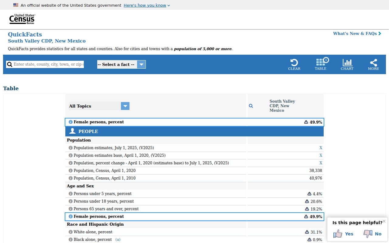
The captured Census view supports the place-level context behind the ZCTA intersections. This South Valley ZIP code directory treats that geography as context, not delivery confirmation or a resident identifier.
South Valley ZIP Boundaries and City Limits
South Valley is a Census-designated place, not an incorporated city. A mailing address can use Albuquerque even when the parcel is in unincorporated Bernalillo County, and a City of Albuquerque system can be relevant only when the address lies within City jurisdiction. County addressing, municipal boundaries, Census CDP lines, and USPS delivery routes are independent systems. This is the central boundary issue for a South Valley postal search.
Do not use a city line printed in a mailing address to decide whether the County Clerk, County Assessor, City Planning, or City Clerk has the record. First confirm the parcel and jurisdiction using the County sources. For an incorporated-area development record, City Planning’s OnBase instructions use StreetNumber, StreetName, and Quadrant. For County property, the Assessor, Treasurer, and County GIS use address or parcel information. A postal ZIP is a useful cross-check, not a custodian selector.
Note: A city name on a mailing label is useful for delivery, but it does not identify the governmental records custodian.
Check a South Valley ZIP Code
The USPS address lookup is the address-level verifier in this workflow. It has three modes: By Address, By City and State, and a ZIP-to-city route. The Postal Service standardizes delivery information and may ask for a unit number where more than one match exists. USPS also warns that a ZIP result does not confirm that a person or business is at the address. That limit makes the tool appropriate for postal validation, not for finding people.
| USPS field | Type | Requirement | ZIP-code use |
|---|---|---|---|
| Company | Text | Optional | Optional delivery context, not an identity check. |
| Street Address | Text | Required for By Address | Starts full-address ZIP verification. |
| Apt/Suite/Other | Text | Optional when applicable | Helps USPS distinguish multiple delivery units. |
| City and State | Text and selector | Required in the appropriate mode | Supports city-state or address search. |
| Urbanization Code | Text | Optional | Used for the Puerto Rico address route, not an ordinary South Valley address. |
| ZIP Code | Numeric entry | Required for ZIP-to-city search | Returns city information for the submitted ZIP. |
Enter the street number, street name, city, state, and unit if applicable. Save the standardized result as a mailing check. Then use the unchanged street components, including the quadrant, for a property or Clerk search. A different postal city label is not an error by itself.
South Valley Postal Records
No verified Bernalillo County Assessor, Treasurer, or Clerk interface offered a ZIP-wide people or property filter during the research sweep. The Assessor is organized around owner, address, and parcel modes. The Treasurer accepts address or parcel ID and has a tax-year filter, although it displayed a maintenance warning at inspection. The Clerk index is strongest when searched by party, date, parcel number, or legal description. A ZIP narrows an address question, but it does not replace the record keys used by these systems.
- Verify one known address with USPS and preserve the returned ZIP plus every address component.
- Use the County Assessor or Treasurer address or parcel search to identify the parcel and its assessed situs. Remove street suffixes in the Treasurer search only as its instructions direct.
- Record the parcel identifier and legal description. The situs ZIP and owner mailing ZIP can differ, so note which field a record displays.
- Move to the Clerk Kiosk with the parcel number, subdivision, lot, block, tract, or survey fields when an instrument is needed.
- After the address is narrowed, use the South Valley Street Directory for the full street-by-street records method.
A voter record should not fill this gap. The New Mexico Voter Information Portal is for an individual’s own registration and needs name, date of birth, and county. Authorized voter data are subject to a written request, affidavit, fee schedule, and statutory restrictions. They are not a public ZIP roster.
Note: A ZIP may help confirm an address, but the legal description is the durable bridge to recorded property documents.
South Valley ZIP Clues for Families
For family and local-history research, postal geography can explain why a directory, library card, or modern mailing label says Albuquerque while a family story says South Valley. It cannot date an old household or replace a historic locality name. The Albuquerque directory collection, stated by the City to run from 1908 to the present, serves South Valley research as part of the larger Albuquerque and Bernalillo records landscape. Request a specific volume and check its street or reverse section before assuming it covers a particular address.
Historic names can matter more than a current ZIP. UNM research identifies Atrisco, Arenal, Los Padillas, and Armijo as South Valley historic villages, and property descriptions can refer to acequia or merced geography. Retain those names as finding aids, then return to the parcel, legal description, plat, deed, or county address assignment for verification. The nearby South Valley Library uses an Albuquerque 87105 mailing address, while Special Collections and Main & Genealogy use 87102. Those different codes demonstrate the local postal and records split rather than a change in identity.
South Valley Situs and Mailing ZIPs
Property systems use more than one address concept. The physical site is the situs address. The owner mailing address is where assessment correspondence goes, and it may be a post office box, agent, or out-of-area location. New Mexico’s 2025 County Parcels service makes the distinction explicit with separate situs street, city, ZIP, ZIP extension, and mailing-address fields. An assessed owner or mailing ZIP is not a statement that the owner currently lives at the parcel.
The New Mexico County Parcels 2025 service shows the field structure that separates situs and mailing ZIP values. It is a GIS service layer, not a public owner-lookup interface and not a USPS replacement.
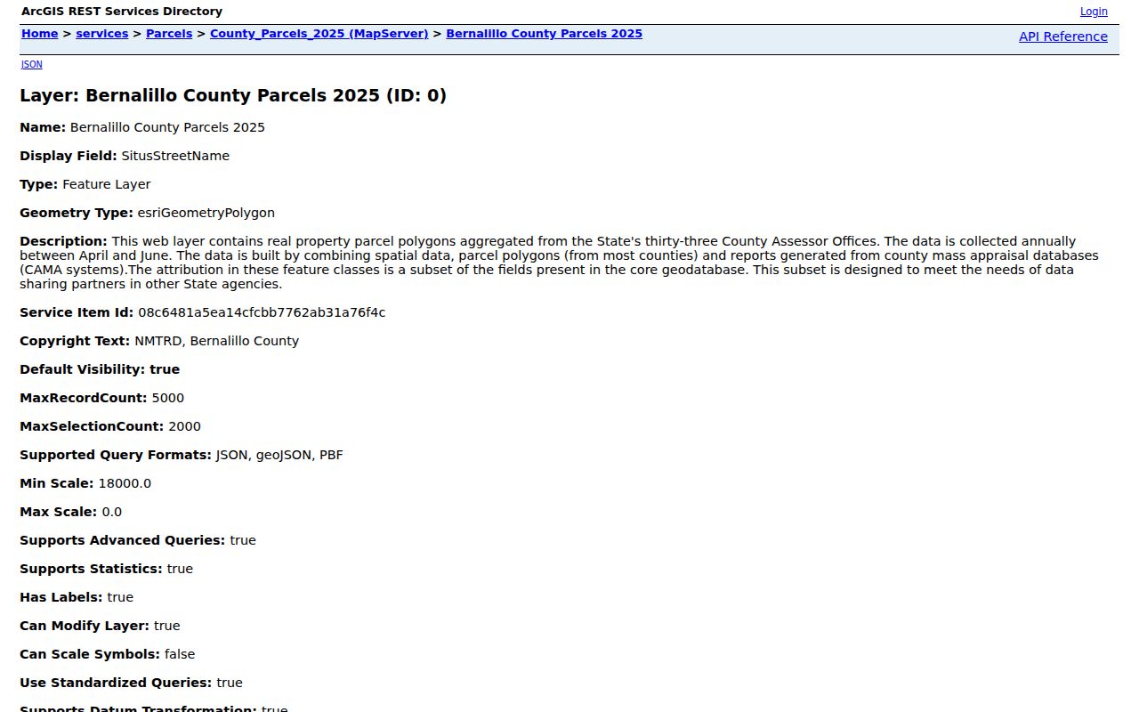
The captured parcel-service view illustrates why a property record can carry distinct physical-site and correspondence ZIP information. Both fields need context before they are used in a South Valley records trail.
County GIS metadata also breaks an address into street number, name, designation, quadrant, apartment, PIN, lot, block, and subdivision. Do not drop SW, SE, NE, or NW from a query. The County Zone Atlas is reference material only, and directs legal-description or dimensions questions to the County Clerk. This is especially important when an old address, current delivery label, and recorded instrument do not use the same wording.
Note: The same parcel can have distinct physical-site and correspondence ZIP values without a delivery or ownership error.
South Valley Postal Limits
A postal directory cannot confirm occupancy, a household, a voter’s address, or an address that a privacy law protects. USPS says its lookup does not confirm a person or business at an address. The Assessor warns that its assessment data are not real time, and its owner field is not a household roster. Court Case Lookup suppresses address and other personal information. Safe at Home protects qualifying participants’ actual addresses through a substitute-address system.
New Mexico voter information has separate restrictions. The own-voter portal is identity checked, and voter data released under NMSA 1978 §1-4-5.5 require the State’s request and authorization process. Protected fields remain withheld. Use aggregate voter-registration statistics by district or precinct for civic context, rather than trying to turn a ZIP into a list of people. If a County or City public record is unavailable online, a narrow written request under the New Mexico Inspection of Public Records Act is the proper fallback, provided the record is public and the custodian holds it.
South Valley Postal Terms
Postal and property terms can look alike while serving different roles. The South Valley ZIP code directory keeps the USPS delivery result, parcel situs field, mailing field, and Clerk legal description in separate notes. That practice prevents a mailing label from being mistaken for a parcel boundary or a person’s residence.
- ZIP and ZIP+4
- A ZIP directs mail to a delivery area. ZIP+4 adds a narrower delivery segment and is not a property-record identifier.
- ZCTA
- A Census statistical approximation of ZIP-related geography. It is not an official USPS delivery boundary.
- PO-box ZIP
- A ZIP used for post-office-box delivery. Research did not establish a South Valley PO-box-only code, so none is assumed here.
- Unique ZIP
- A ZIP assigned for a single organization or high-volume receiver. Research did not verify one for South Valley.
- Carrier route
- A Postal Service delivery sequence within an area. It does not identify a property owner or residents.