
South Valley Street Directory Walkthrough
A South Valley street search starts with property geography, not a claim about every person at an address. South Valley is a Census-designated place that crosses unincorporated Bernalillo County territory and places with Albuquerque municipal context. Find the applicable jurisdiction first. A County parcel card can connect a street address to a parcel number and legal description. A recorded document can then connect that description to a dated transaction. Historical sources may add a household clue for a particular year, but they should not be treated as a current roster.
Keep a small trail of the exact address spelling, parcel identifier, legal description, document number, date, and source. That practice helps when a street string changes between systems. It also keeps the central distinction clear: an assessed owner, a deed party, a mailing recipient, and a current occupant are different facts. The public records below are most useful for family history, estate questions, property curiosity, and verifying a transaction with the office that holds it.
- Enter the complete address in the applicable County property search or City map tool, and record the situs address exactly as returned.
- Capture the parcel identifier and legal description. A parcel is the land unit tracked by the assessment roll.
- Check the County map or reference atlas for lot, block, subdivision, quadrant, and street geometry.
- Search the Bernalillo County Clerk Kiosk by parcel number or legal-description fields rather than relying on a street name alone.
- Record grantor, grantee, recording date, document number, book or page, and the legal description from the instrument.
- For an incorporated-area development clue, use the City planning route by street number, name, and quadrant.
- For a past household question, request the relevant Albuquerque directory volume and confirm whether it contains a street or reverse section.
South Valley Street Records by Address
Each South Valley address-keyed source answers a limited question. The assessment roll is the current County starting point for a parcel and assessed ownership. Treasurer data adds tax-account context. The Clerk records the legal instruments that move or burden an interest in land. GIS supplies reference geography. City planning material can supply an address or permit-linked chronology only where City jurisdiction applies. Historical volumes can place a listed name at an address in a volume that actually covers that street.
| Address record | Custodian | Useful result | Access route |
|---|---|---|---|
| Assessment parcel card | Bernalillo County Assessor | PARID, assessed owner, situs, value, tax year, and listed exemptions | Public Property Records after disclaimer |
| Tax account | Bernalillo County Treasurer | Address or parcel tax context and selected tax year | Public search, with counter fallback during maintenance |
| Recorded instrument | Bernalillo County Clerk | Grantor, grantee, recording data, legal description, and parcel linkage | Clerk Kiosk, copy cart, or counter |
| Parcel reference map | County Planning and Development GIS | Lot, block, subdivision, address parts, PIN, and geometry | Base-map metadata and Zone Atlas |
| Certificate of Occupancy case | Albuquerque Planning | Address or permit-linked approval trail where incorporated | OnBase, ABQ-PLAN, or a narrow City request |
| Historic directory volume | Library, Special Collections, or UNM | Potential name, address, and printed context for a selected year | Request the actual volume and section |
Use the legal description as the handoff between the parcel card and a deed. It is more durable than an address in older instruments. A street directory search may show a useful owner or historical entry, but it cannot turn a tax roll or map result into proof that every person at that location currently resides there.
Note: A mailing address on an assessment record shows where the County sends correspondence, not where an owner necessarily lives.
South Valley Parcel Search Fields
The Bernalillo County Assessor public-access entry leads to address, owner, and parcel search modes after its disclaimer. The office says the information is not real time and asks users to investigate and verify it independently. For a street-level trail, retain the returned PARID or uniform property code, situs address, assessed owner, tax year, and legal description. The complete parcel card may also show an owner mailing address, but that field remains correspondence information rather than occupancy proof.
| Address mode | Use the physical site address to locate a parcel record. |
|---|---|
| Owner mode | Use a spelling from a deed or other documented record, then confirm the returned parcel. |
| Parcel mode | Use the PARID or UPC when a street query produces more than one result. |
| Tax year | Preserve the displayed year before comparing values or exemptions. |
| Legal description | Carry lot, block, subdivision, tract, or survey wording into the Clerk search. |
The Assessor form is a starting tool, not a final certification. When a result concerns a current transaction, verify the current record with the Assessor and then the Clerk. The County Treasurer offers an independent address or parcel-ID path with a tax-year filter. Its instructions say to omit street suffixes when using its address field and allow wildcard patterns for parcel IDs.
The following source image shows the Assessor access screen that precedes the property form: Bernalillo County Assessor Property Records.
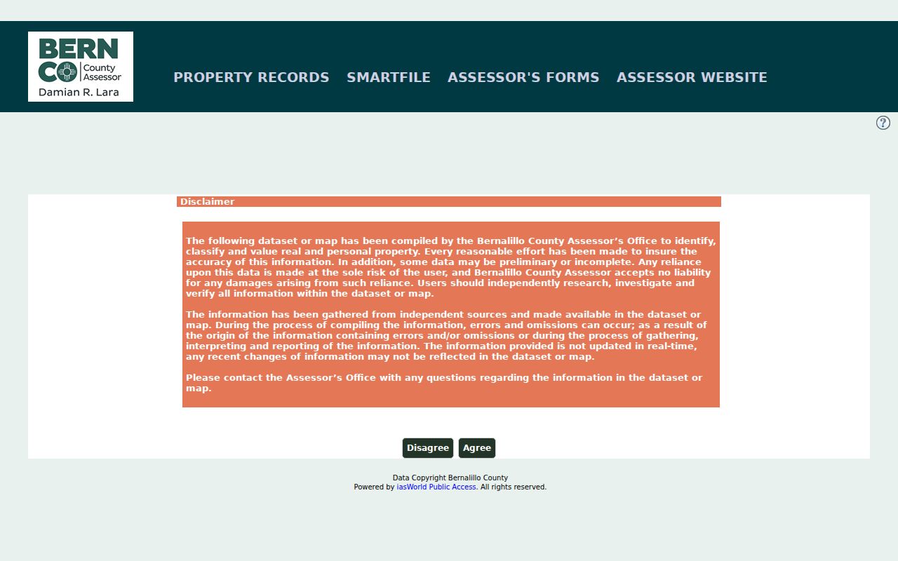
Accepting the notice opens the property-search path, while the notice itself explains why a parcel result needs current-office verification.
The related address and parcel-ID form is available through Bernalillo County Treasurer Property Tax Search.
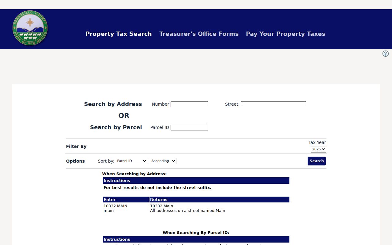
The Treasurer screen adds a tax-year filter and a second official parcel route, although maintenance notices can require a counter or phone fallback.
South Valley GIS by Jurisdiction
Use City GIS only after confirming that the address is within City coverage. Albuquerque’s Advanced Map Viewer offers a searchable, multilayer map, while the City Address Report may return Assessor-sourced ownership, City-service, and political-boundary context. The City parcel popup can show a UPC, owner, situs address, owner address, legal description, acres, tax fields, and a document number. City metadata says Assessor parcel data is supplied twice each year, so use the County Assessor for the current owner and value check.
For an unincorporated South Valley street, use County Assessor, Treasurer, and Planning and Development GIS material. The County base-map schema includes street number, name, designation, quadrant, apartment, PIN, lot, block, subdivision, address, and GIS acres. Its maps are reference tools, not legal descriptions. The County’s Zone Atlas directs legal-description and dimensions questions to the Clerk, and Planning and Development Services makes official address assignments.
The County’s address-field schema is illustrated by Bernalillo County base-map metadata.
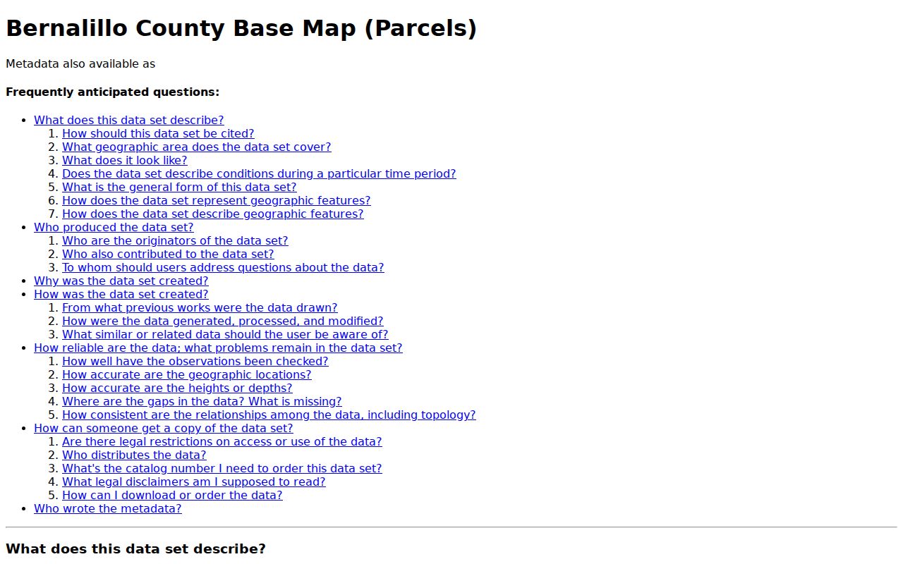
Those separate fields explain why a complete address, including the quadrant and unit where relevant, is safer than a loose street-name search.
South Valley Address Quadrants
South Valley records can carry Albuquerque mailing labels, County identifiers, and City systems without sharing one jurisdiction. Postal wording alone does not decide which office has the record. Address parts matter, too. County GIS breaks a location into street number, street name, designation, quadrant, and apartment. City Certificate of Occupancy instructions separately use StreetNumber, StreetName, and Quadrant. Do not remove SW, SE, NE, or NW from a search unless testing a documented variant.
When a modern street address fails in a historical deed, move back to the legal description instead of forcing today’s postal city or ZIP label into the old record. An older source may use a rural route, Albuquerque, South Valley, or a historic locality name. Atrisco, Arenal, Los Padillas, and Armijo appear in local historic context, and acequia or merced geography can appear in maps or oral histories. Those are useful leads, but the Clerk’s legal description remains the record bridge.
- Parcel
- A defined land unit tracked by the assessment system and commonly identified by a PARID, PIN, or UPC.
- Situs address
- The physical property location carried on a parcel record, distinct from an owner correspondence address.
- Plat
- A recorded map that can identify lots, blocks, streets, and a subdivision layout.
- Criss-cross directory
- A street-order directory section, if the individual historical volume includes one.
South Valley Deed Chain
The Bernalillo County Clerk Document Search and Copies portal is the key deed route for a South Valley street directory trail. Its displayed certification range runs from January 1, 1800 through July 6, 2026. That is a portal statement about certified recorder documents, not a promise that every image, spelling, or historic address is indexed in the same way. The portal allows name, grantor, grantee, date, document number, book and page, parcel number, and detailed legal-description fields.
Begin with the current parcel and legal description. Search the parcel number, then narrow through subdivision, lot, block, tract, unit, or public-land-survey fields. From a recent conveyance, record the grantor, grantee, recording date, document number, and legal description. To move farther back, search the seller as grantee while holding the legal description steady. The Clerk Kiosk supports exact last-name-first searching and advanced wildcard, Boolean, fuzzy, and proximity options, which can help with recorded name variations but never establish identity by themselves.
| Grantor | The party conveying or otherwise recording an interest in the indexed document. |
|---|---|
| Grantee | The receiving party named in a conveyance or similar instrument. |
| Document number | The direct recorded-document reference to retain for a copy request. |
| Book and page | An older citation path that can help locate historic material. |
| Legal description | The lot, block, subdivision, tract, or survey description that holds the parcel trail together. |
Copies and certified copies use the portal cart or the Recording and Filing counter at 415 Silver Ave. SW. Confirm the current charge in the cart or with the Clerk rather than assuming an amount from a general record search.
South Valley Planning Address Records
For a South Valley parcel that lies inside Albuquerque, City planning records can date a development event without becoming a resident list. The City’s planning instructions say Certificates of Occupancy can be searched in OnBase by choosing Building Safety - Certificate of Occupancy and then using StreetNumber, StreetName, and Quadrant, or a COPermitNumber. Other planning cases can be searched by address or a project or case number. Building permits themselves are not publicly available through that web channel.
Planning system names also help frame a narrow request. Cognos covered 1999 to 2008, Kiva 2008 to 2018, POSSE/MESA 2018 to 2025, and ABQ-PLAN began in January 2025. Pre-1999 applications can have letter-prefixed project numbers. If the online result lacks the needed file, use the City Clerk’s ABQ Records process for an address-specific, date-bounded request. City coverage is not implied by an Albuquerque postal line.
This image comes from the City’s planning case tracking and research instructions.
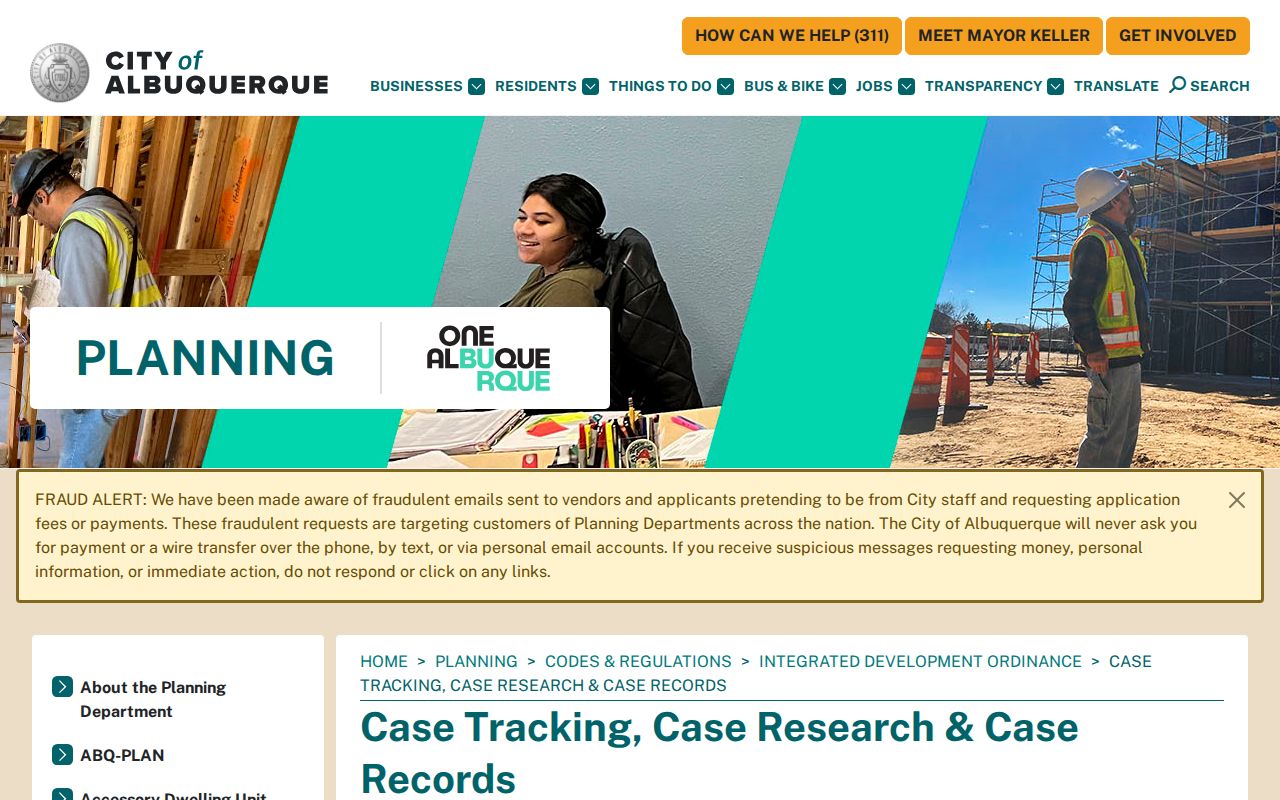
Use the published search type and individual address fields, then ask the City Clerk for the missing record rather than broadening the request into a people list.
South Valley Historical Street Clues
Historical address work belongs with the Albuquerque directory collections, not a separate printed South Valley series. The City identifies Albuquerque City Directories from 1908 to the present at Albuquerque Public Library and UNM’s Center for Southwest Research. Ask for a specific year and ask whether that volume includes a street or reverse section. A historical entry may offer a printed name, address, occupation, or notation for that year. It may also omit a South Valley household, use a different locality label, or lack the desired street section.
Special Collections, Main & Genealogy, and UNM provide the documented library and archive routes. For a backward household trail, directory entries work best after a parcel and date range are known. The historical shelf is covered in more detail in the South Valley Directory Book; return to the Clerk legal description when a listed address must be linked to a recorded instrument.
Note: A directory entry is a dated publication clue, not proof of a present address, household membership, or legal ownership.
South Valley Voter Boundaries
The New Mexico Voter Information Portal is for a voter’s own registration, ballot, and polling-place information. It is not a browse-by-street directory. The documented lookup asks for first name, last name, date of birth, county, and a verification step. South Valley registrations use Bernalillo County, but that does not authorize a public search of names along a road.
New Mexico law allows certain voter data through a written request, payment, and statutory authorization process. The released product remains restricted, excludes key personal fields, and protects Safe at Home information. For geographic context, use the State’s voter registration statistics by district, precinct, or county instead of treating voter data as a street roster. A voter result or absence does not establish who lives at a parcel.
South Valley Street Directory Limits
A South Valley street directory cannot show a complete list of current occupants. No verified official source supplies a searchable list of every non-owner occupant, household member, utility customer, delivery recipient, or DMV-address holder on a street. Court Case Lookup removes address and other personal identifying information. The assessor is not real time. A parcel owner can use a separate mailing address, and an ownership entity can hold land without identifying the people present there.
Some absences are intentional. New Mexico Safe at Home safeguards qualifying participants’ actual addresses through a substitute-address program. Sealed or restricted court material, protected voter information, and motor-vehicle privacy limits also remain outside normal address research. A missing result is not a reason to combine sources in an effort to expose someone.
Lawful use. Use South Valley address records for personal, lawful research and stop when a source withholds protected information. Stalking, harassment, threats, or attempts to defeat an address protection are prohibited.
South Valley IPRA Address Requests
When an identified public record is not online, New Mexico’s Inspection of Public Records Act provides the written fallback. A useful request names the custodian, record type, specific South Valley address or document number, date span, and preferred inspection or electronic-copy method. It asks for a defined existing record. It does not require a County or City office to create a new list of people associated with a street.
Under the documented statewide procedure, a written request that cannot be fulfilled within three business days receives a written timing explanation, and inspection or a response is due as soon as practicable and no later than 15 days after receipt. For City-held material, use ABQ Records online, by mail, or in person. For County records, call the Clerk at 505-468-1290 or use the County’s custodian route with the legal description or document number already in hand.
Note: A narrow request is easier for a records custodian to locate and review than an open-ended request for everyone connected with a street.
South Valley Street Trail Checks
Before relying on a street-level result, compare at least two compatible records. A parcel card and current Clerk instrument can support an assessed-owner and recorded-transaction trail. A City planning case can add a dated approval in the incorporated area. A selected directory volume, census release-period source, obituary, or newspaper microfilm can add historical context. Each source should retain its own date and limit.
Stop if the address, legal description, quadrant, or jurisdiction does not match. A County map is a reference layer, and a City parcel display has a stated update lag. The best final confirmation is often a current office response, recorded copy, or certified document from the relevant custodian. That approach keeps the South Valley street directory useful without overstating what public address records can prove.